Road Miles by State
Planning Data
Kristen Carney

This blog post was updated on April 30, 2021.
I find myself googling for this data once a month or so. I just can’t seem to remember where to find it on the Federal Highway Administration’s website. Below are states by total 2019 lane miles–which is the most recent dataset available today and is dated September 2020.
Road Miles by State: Sorted from Most to Least
| STATE | TOTAL LANE MILES |
| Texas | 683,533 |
| California | 396,540 |
| Illinois | 306,658 |
| Minnesota | 290,618 |
| Kansas | 286,606 |
| Missouri | 277,504 |
| Florida | 275,376 |
| Georgia | 272,662 |
| Ohio | 262,492 |
| Michigan | 256,579 |
| Pennsylvania | 251,708 |
| New York | 240,489 |
| Wisconsin | 239,318 |
| Oklahoma | 238,754 |
| Iowa | 235,549 |
| North Carolina | 229,011 |
| Arkansas | 210,729 |
| Alabama | 210,531 |
| Tennessee | 203,850 |
| Indiana | 202,707 |
| Nebraska | 193,996 |
| Colorado | 185,486 |
| North Dakota | 178,845 |
| Washington | 167,632 |
| Kentucky | 166,971 |
| South Dakota | 166,635 |
| South Carolina | 166,594 |
| Virginia | 164,132 |
| Oregon | 162,101 |
| Mississippi | 162,088 |
| Montana | 150,446 |
| New Mexico | 150,216 |
| Arizona | 146,465 |
| Louisiana | 134,115 |
| Idaho | 107,568 |
| Utah | 102,031 |
| Nevada | 100,805 |
| New Jersey | 85,108 |
| West Virginia | 80,167 |
| Massachusetts | 77,730 |
| Maryland | 71,129 |
| Wyoming | 62,620 |
| Maine | 46,736 |
| Connecticut | 45,916 |
| Alaska | 36,009 |
| New Hampshire | 33,391 |
| Vermont | 29,273 |
| Delaware | 14,069 |
| Rhode Island | 12,664 |
| Hawaii | 9,799 |
| District of Columbia | 3,445 |
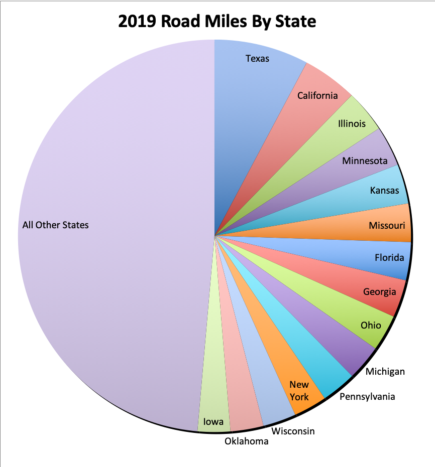
Pie Graph Showing 2019 Lane Miles by State
And just for fun, here’s a pie graph of this table.
Helpful Links with Road Miles by State data
If you need historic data like lane miles for 1980 to 2007, check out Functional System Data; Estimated Lane - Length page. If you need Function System data for 2008 (i.e. interstates, freeways, arterial, collectors and local), check out FHWA's Functional System Lane-Length - 2008 Lane-Miles page.
And below are links to FHWA’s Functional System Lane-Length by year. You can download PDF and Excel versions of the data on these pages.
- 2009 Lane Miles
- 2010 Lane Miles
- 2011 Lane Miles
- 2012 Lane Miles
- 2013 Lane Miles
- 2014 Lane Miles
- 2015 Lane Miles
- 2016 Lane Miles
- 2017 Lane Miles
- 2018 Lane Miles
- 2019 Lane Miles
Got questions? Email us.
3 Comments
-
ChristopherCan you please define 'lane mile' for me? Also, are these totals for all public roads (interstate, freeway, commercial, residential, etc)?
Thanks!
Chris-
Hey Chris,
For those details, head over to the FHWA's website. I've included links in the post.
Cheers!
Kristen
-
-
B LundI have seen numbers as high as 2+ M miles of roads, all types, for California alone. These numbers are always low as they don't usually count privately owned roads (ranch, private logging lands, etc.) and they don't count primitive roads on USFS or BLM lands which can be in the thousands per county alone.
We should have a listing for alternative numbers ...